

Yosemite National Park Recreation Map app for iPhone and iPad
Developer: Earthrover Software
First release : 04 Jun 2009
App size: 19.81 Mb
This app brings the Yosemite National
Park Recration Map from Tom Harrison Maps
to the iPhone and iPod touch.
*NOTE: If you are having trouble with GPS updates, increase the duration on the Options screen*
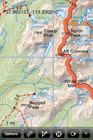
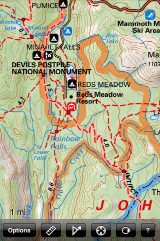
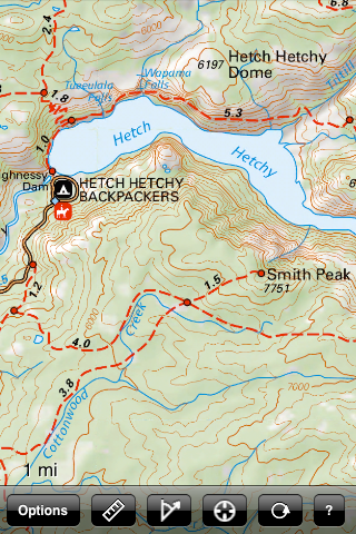
The map covers all of Yosemite National
Park, as well as Devils Postpile National
Monument, June Lakes, and the western shore
of Mono Lake. All map data is included
in the app itself--you dont need an internet connection at all to use the app.
For more detailed coverage of Yosemite Valley, see our Yosemite Valley Trail Map.
The map shows trails, backcountry roads,
highways, towns, water features, peaks,
canyons, campgrounds, and ranger stations,
all on a shaded relief topo map with 200-foot contours. This map is perfect for hiking, backpacking, mountaineering, geocaching, or just checking out this stunning region from the pavement.
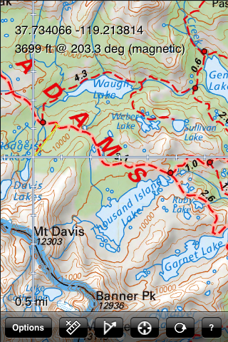
Navigate the map using standard touch
gestures to zoom and drag. Mark your
location, measure distances, orient
yourself by taking bearings to landmarks,
and use your iPhones GPS to find your
location on the map. Add your own markers
to the map, and export them via email for
display in Google Earth or other
applications.